|
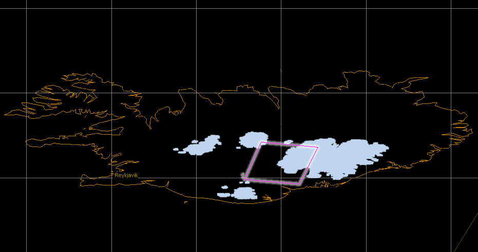
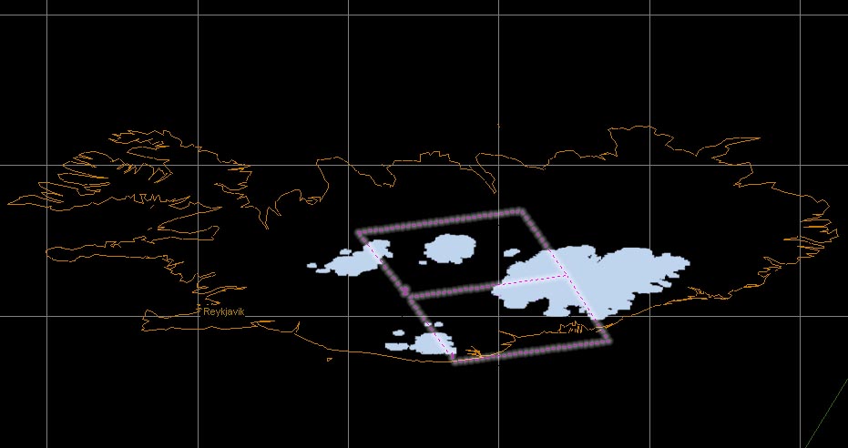
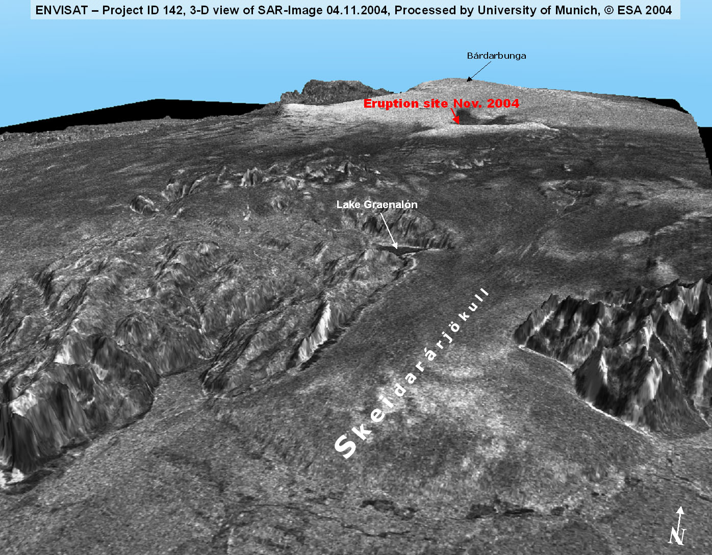
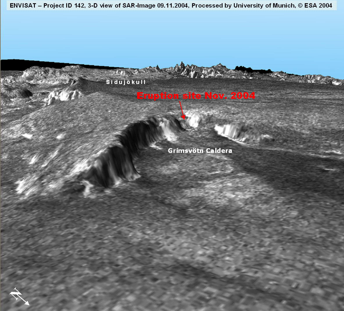
The Grímsvötn area is one of the testsites in the ENVISAT
project ID 142 "Hazard Assessment and Prediction - Longterm
Observation of Icelandic Volcanoes and Glaciers Using ENVISAT-ASAR
and Other Radar Data". Therefore a continuous acquisition
of ENVISAT-ASAR
data (modes IS 2, IS 5) from the study area is guaranteed.
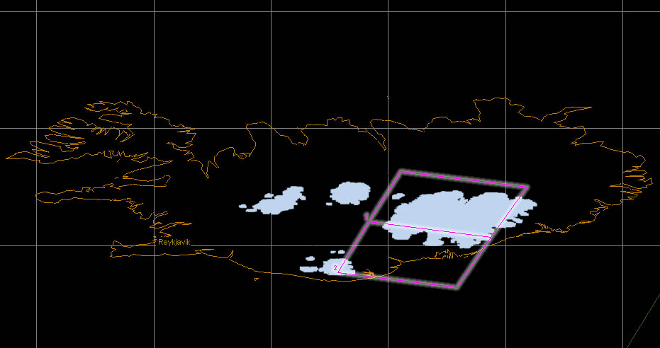
The overall purpose of the AO Project is the monitoring of
changes in glacier and other surfaces caused by geothermal,
seismic and volcanic activity in the neovolcanic zone in southern
Iceland.
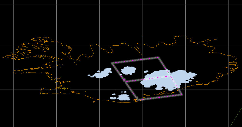
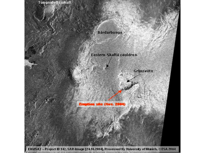
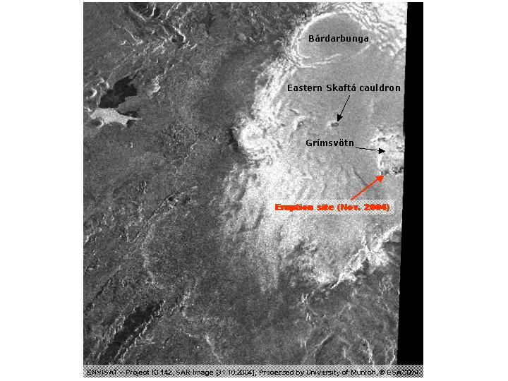
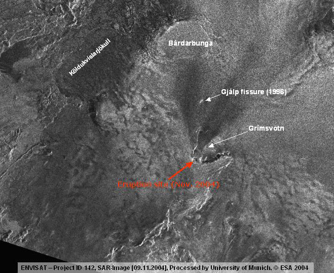
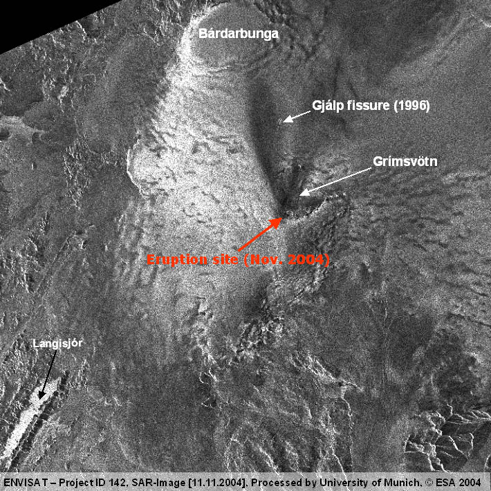
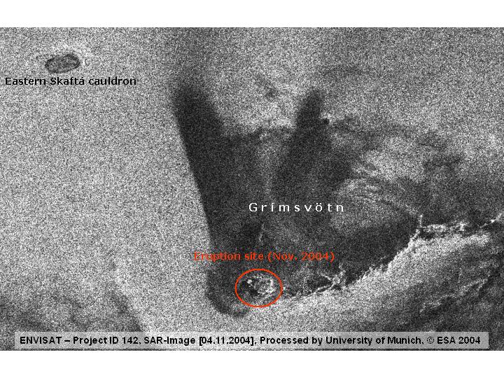
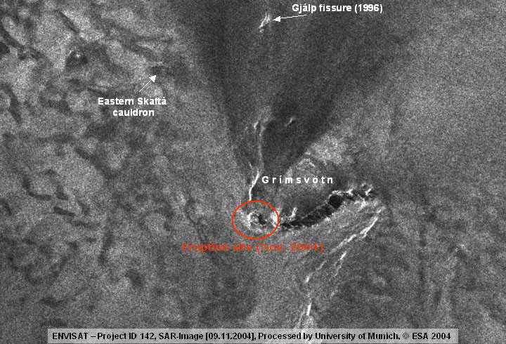
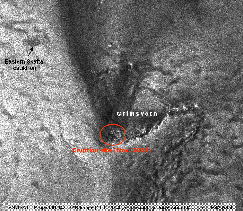
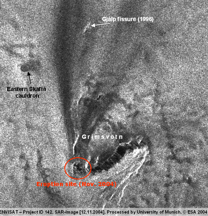
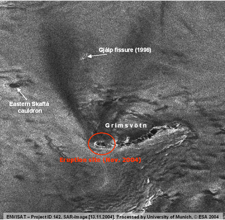
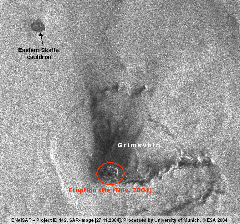
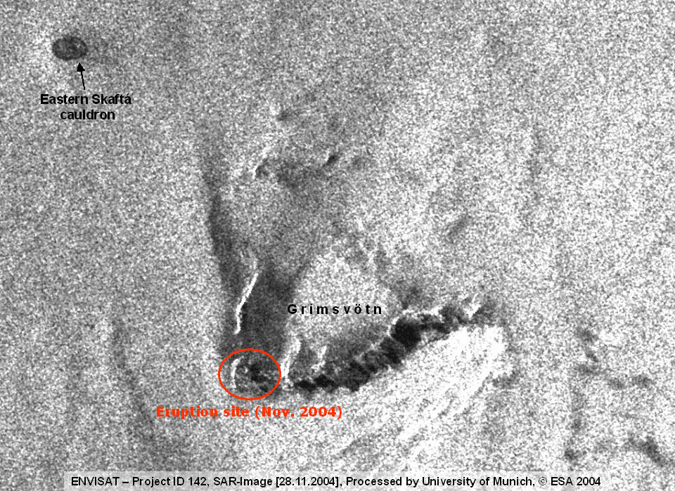
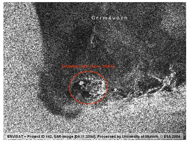
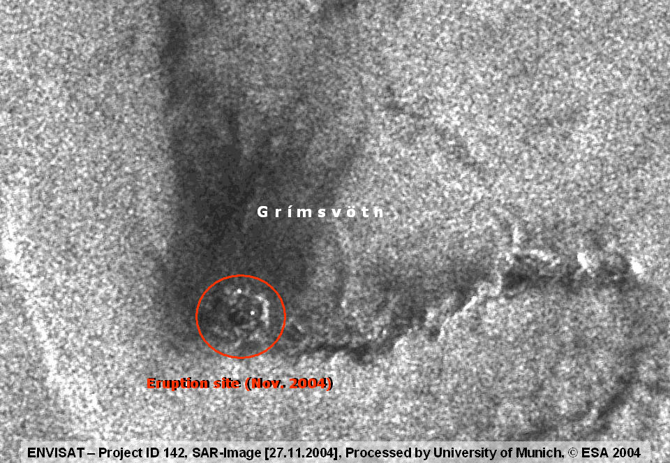
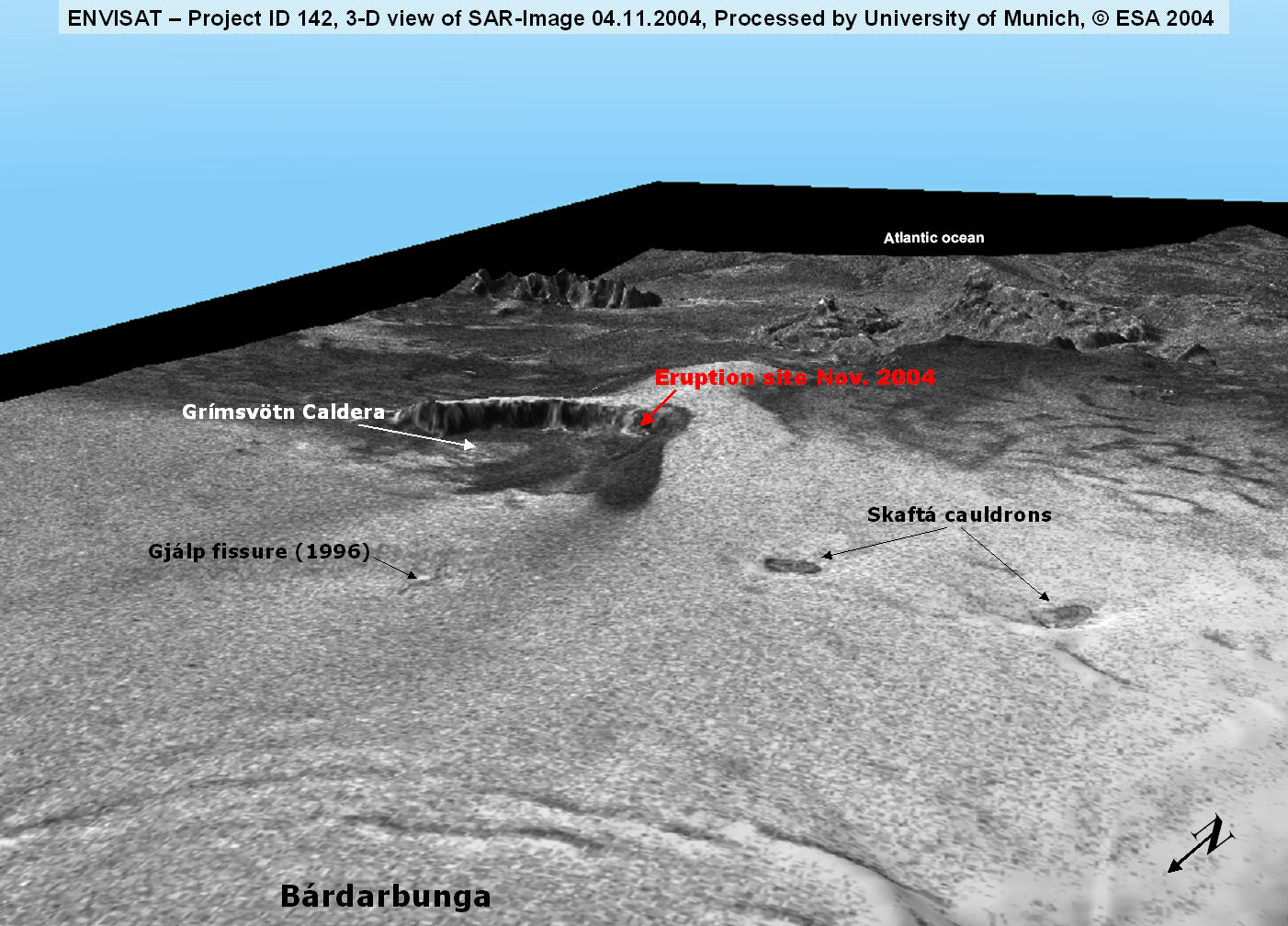
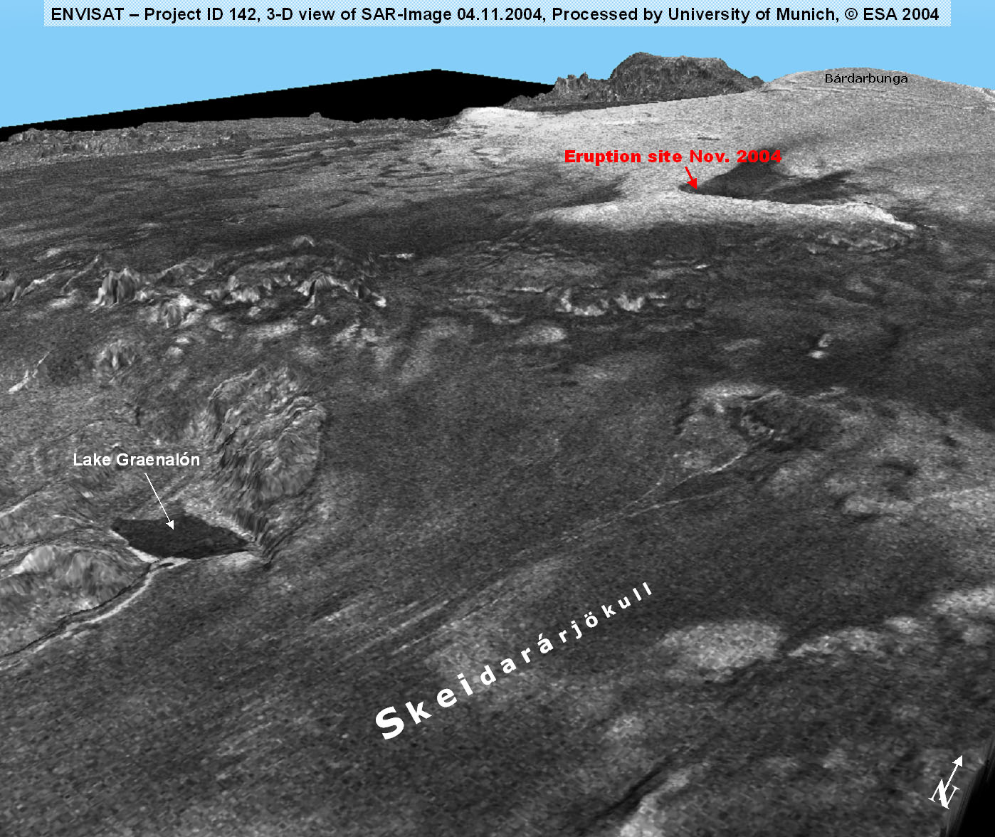
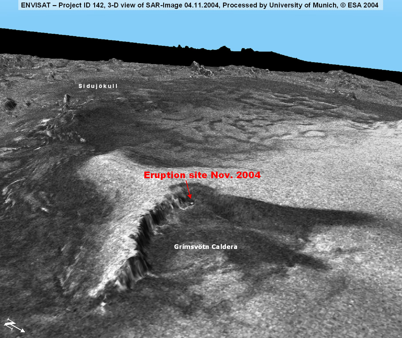
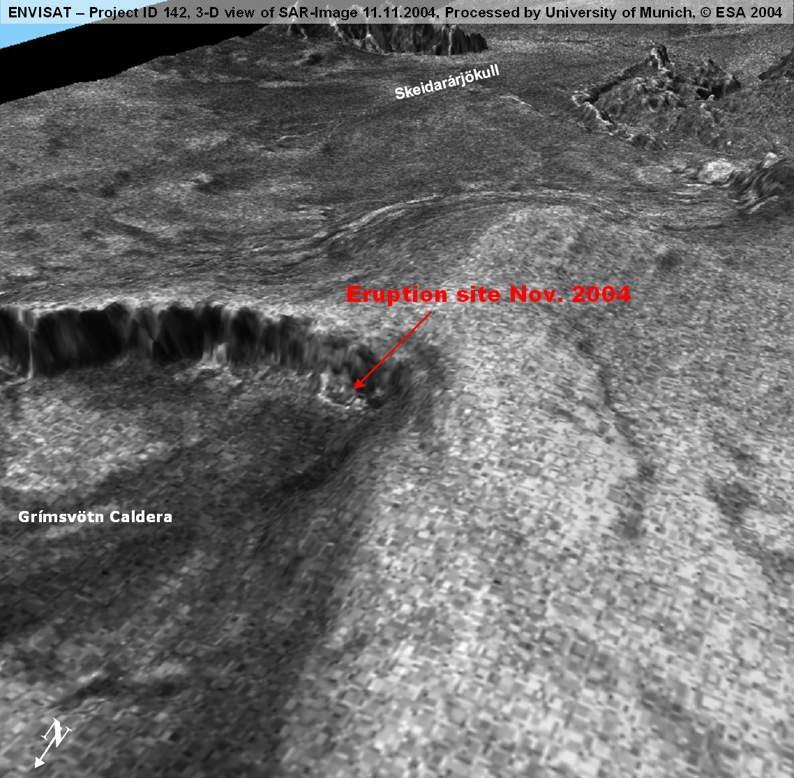
On
November, 1st 2004 (ca. 22.00 GMT) an eruption at Grímsvötn
caldera - a subglacial volcanic system beneath the western
part of Vatnajökull glacier - started, after a dormant phase
of only 6 years since its last outbreak in December 1998.
In spite of the usual eruption characteristics a glacial torrent
(icl. Jökulhlaup) occured (30.10.2004) before the hot phase
and triggered the eruption due to the release of the overburden
water pressure.
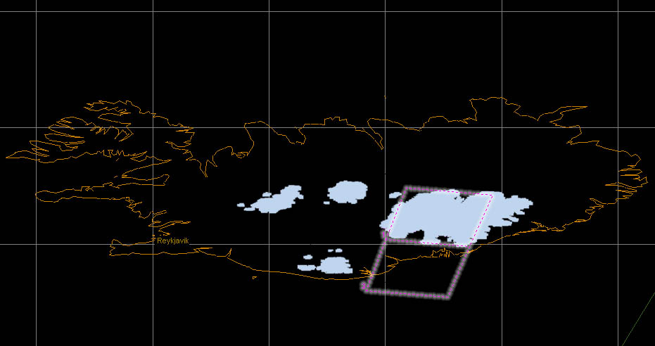
Due
to special arrangement with ESA it is possible now to receive
and process ASAR data around 24 hours after acquisition.
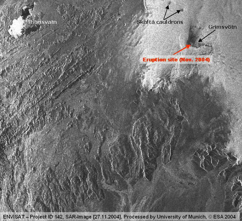
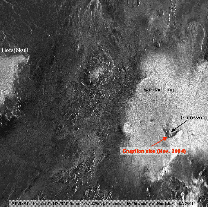
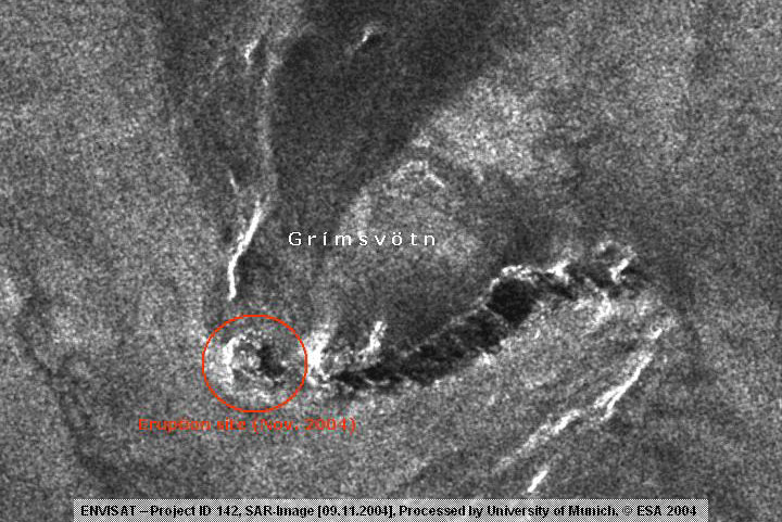
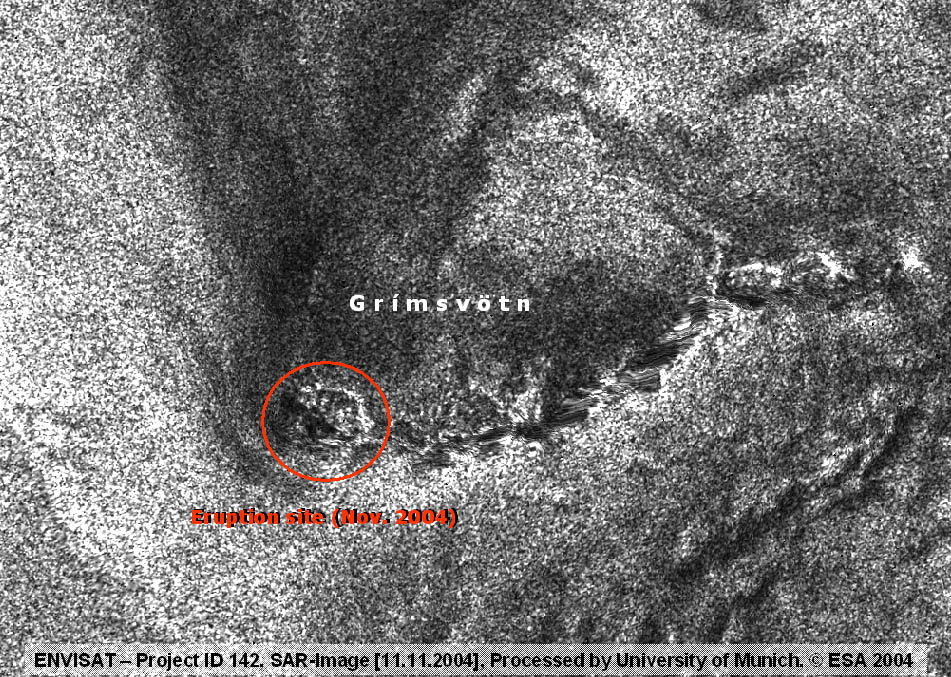
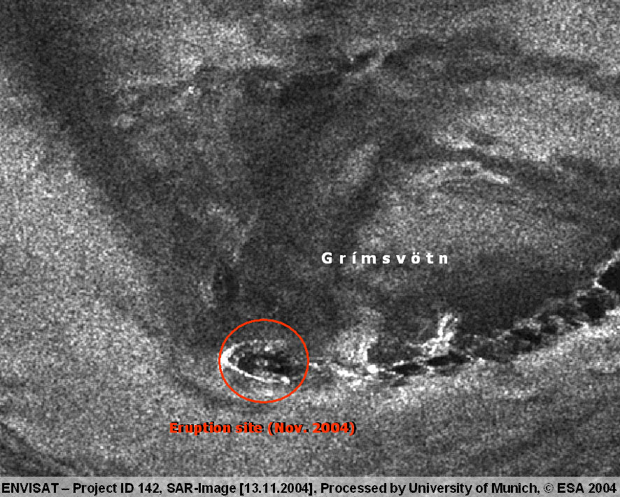
The 2004 eruption period is covered by a data sequence with
short acquisition intervals. This gives us the unique chance
of NRT observation of a subglacial outbreak over the whole
eruption period. The scenes dating from 24.10.,
31.10., 04.11., 09.11., 11.11., 12.11., 13.11., 27.11. and
28.11.2004
have already been received and fully integrated in our hazard
monitoring GIS.
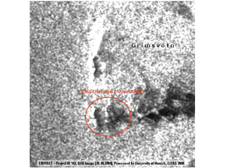
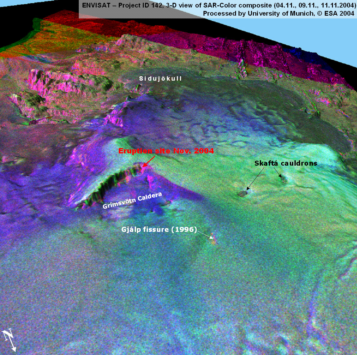
Early
recognition of subglacial volcanic processes by radar monitoring
(ESA-project AO 2 D 116) was possible during the subglacial
volcanic eruption of Gjálp (30.9.-13.10.96) and Grímsvötn
(18.-28.12.98) and has now been confirmed as a suitalbe tool
by the new eruption (Nov. 2004).
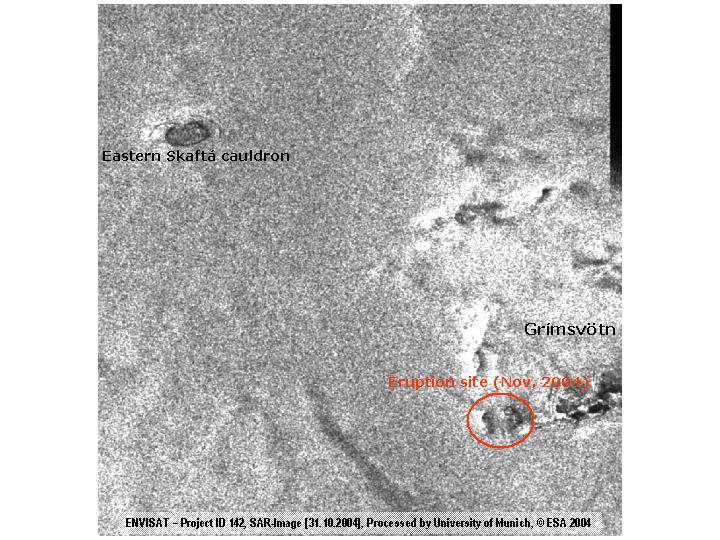
Evaluation of the new ASAR data showed that 8 days ahead of
the recent eruption on 24.10.04 the exact position of the
eruption site inside the caldera could be located through
the glacial ice cover. 35 hours prior to the eruption, on
31.10.04, the extent could be detected in detail.
This indicates at least 8 days before the eruption there has
been a magma intrusion under the Grímsvötn caldera with the
effect of melting the glacial ice layer from underneath. The
meltdown led to the glacial torrent on 30.10.04 which then
indirectly triggered the eruption.
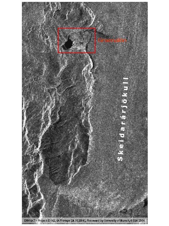
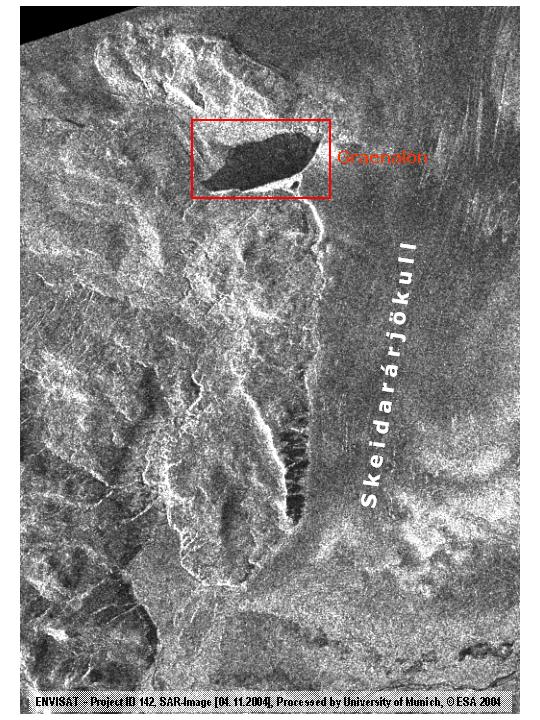
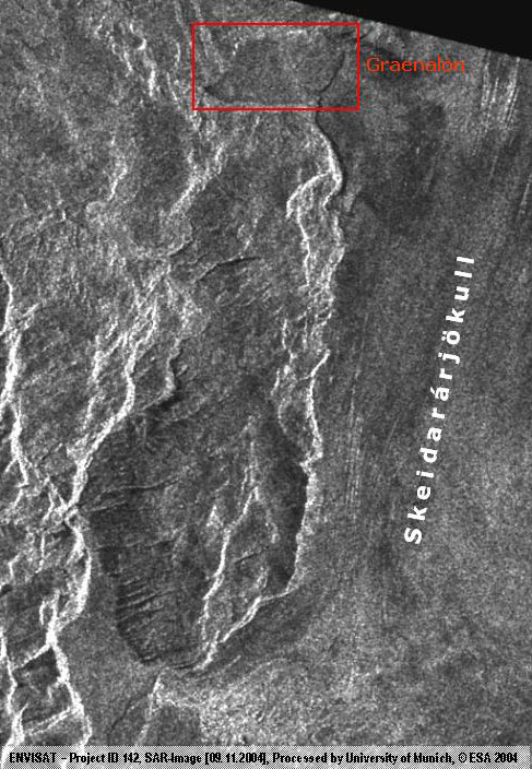
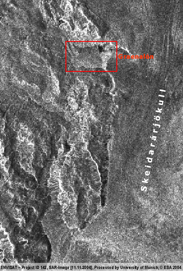
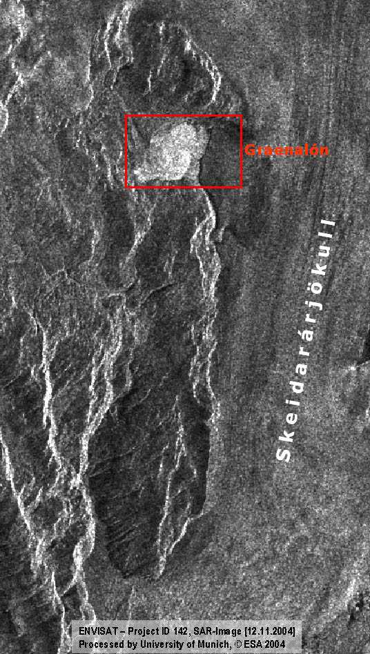
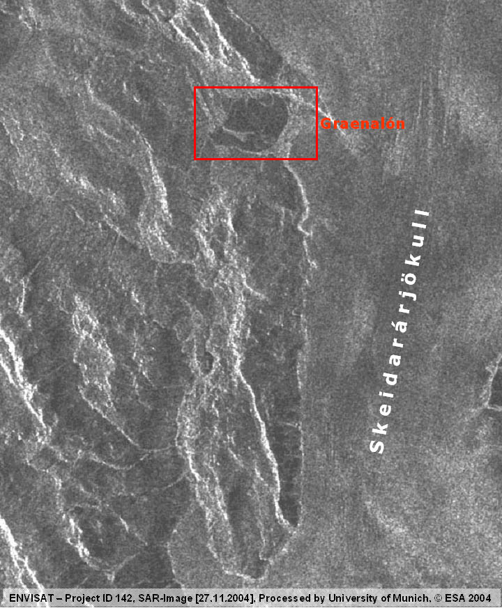
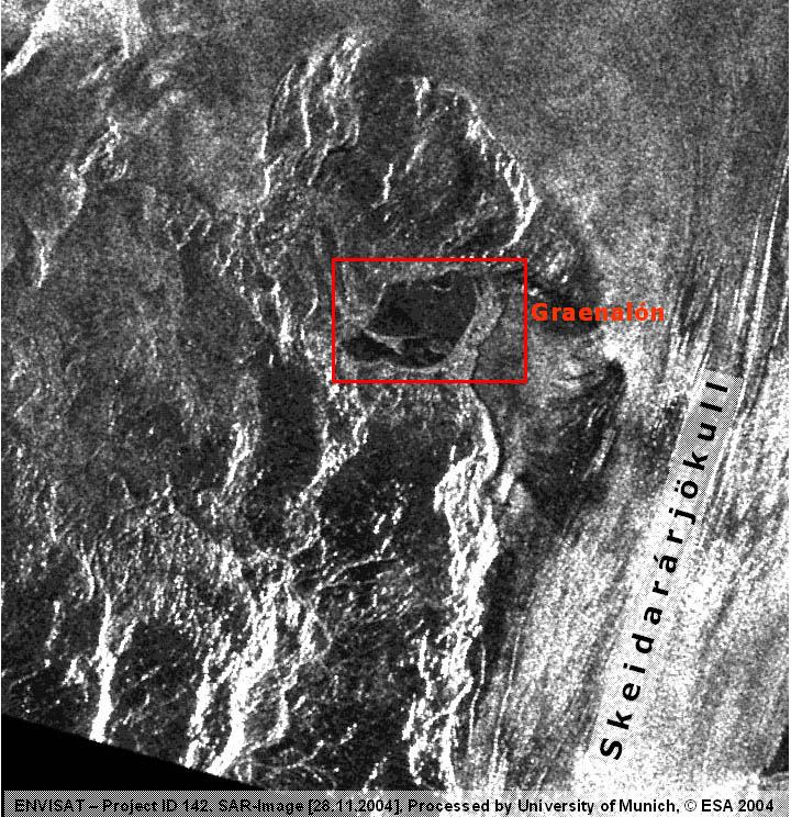
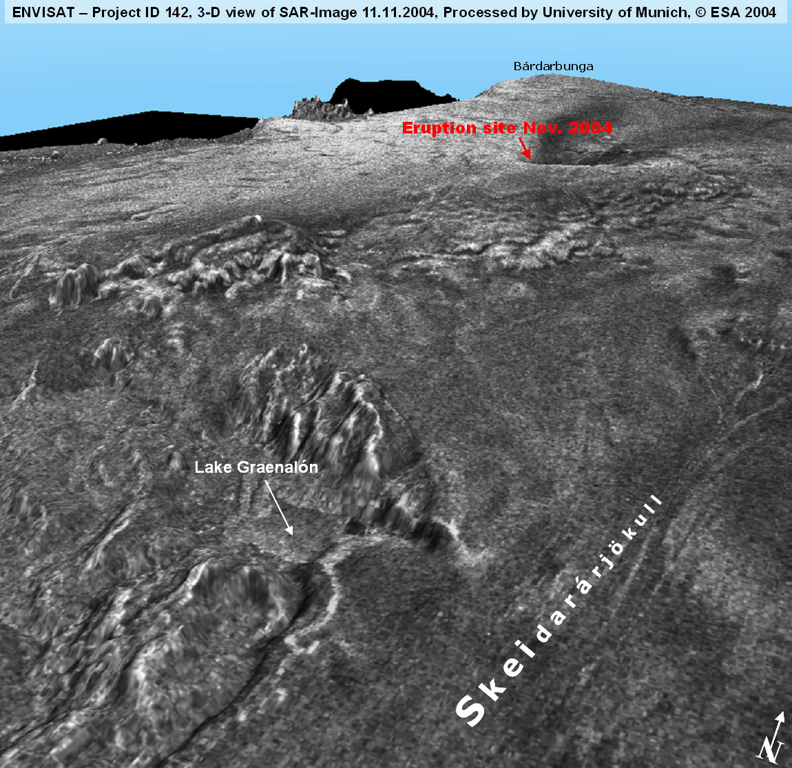
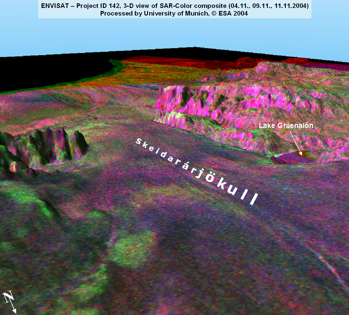
Moreover
examination of the ASAR data (31.10./04.11./09.11./11.11./12.11.
and 13.11.04)
show enormous water level changes in lake Graenalón, a water
reservoir close to the Skeidarárjökull.
The
ENVISAT-ASAR data sequence will
be continued.
Last
Update : 03.12.04
|